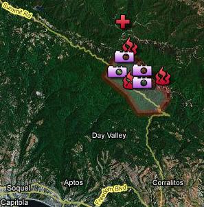
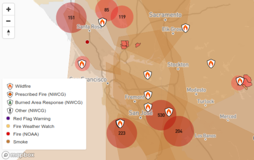
The cool thing (pun not intended) about using dynamic maps for emergency services, is that real-time data is easily visualized. This is a huge benefit to disaster recovery and incident response groups, as well as friends and family: The San Jose Mercury News has created an excellent example of just such a map:
Firefighters are evacuating residents near a wildfire that is burning out of control in the Santa Cruz Mountains.

Your company should have something like this ready to go as part of your continuity and emergency plans.
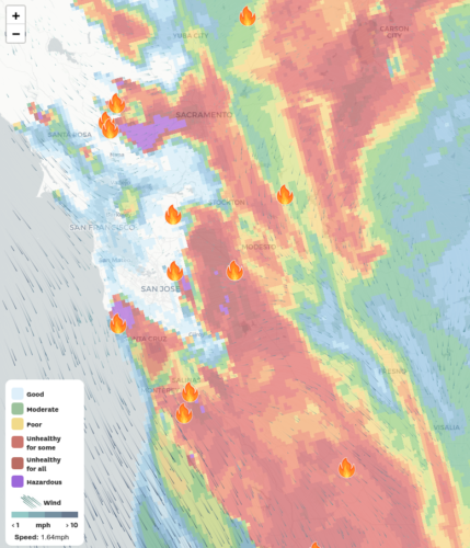
Update August 2020: The San Francisco Chronicle has a real-time air-quality map that tracks fires in the region
See air quality in your area in near-real time. This map shows ratings for the Bay Area and California, updated hourly.
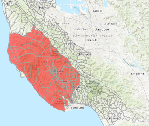
ArcGIS is hosting a CalFire map of evacuation areas:
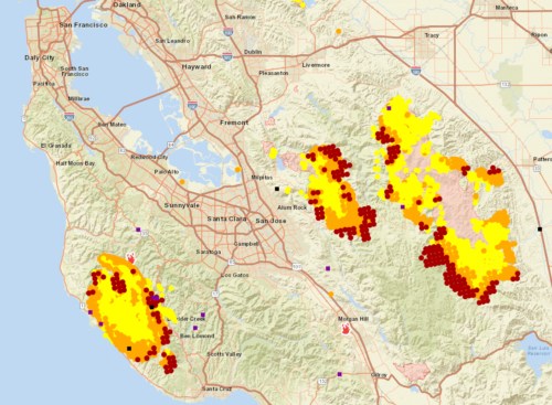
National Fire Situational Awareness maps are on the National Wildfire Coordinating Group (NWCG) site
And Esri offers an embedded #FireMappers Wildfire Early Notification Map
And data.thecalifornian.com has its own fire map pulling from the NWCG site
San Diego’s Supercomputer Center WIFIRE project is trying to use all this data to predict wild fires of the future.
And Google has just announced a new real-time fire-tracking feature in maps:
Type in the name of an ongoing wildfire into Google search, and the site will now bring up a map featuring a near-real-time boundary of the fire.