
Scientists are perfecting their ability to survey penguins by using high-resolution satellite imagery. The birds now can only hide by flying (underwater)
The satellites are actually providing the first ever species-wide population count of an animal. The space-based species census had good news:
“We are delighted to be able to locate and identify such a large number of emperor penguins,” lead author Peter Fretwell, a geographer for the British Antarctic Survey, said in a press release. “We counted 595,000 birds, which is almost double the previous estimates of 270,000 – 350,000 birds. This is the first comprehensive census of a species taken from space.â€
Any guesses what the next target species will be? The secret sauce to the surveillance seems to be linked to waste analysis.
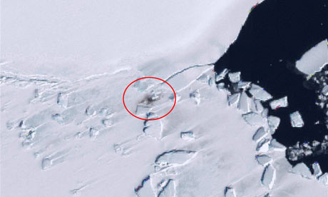
Although finding a great splurge of penguin poo on the ice is a fairly straightforward – if laborious – process, counting individual birds in a group huddle is not, even in the highest resolution satellite pictures.
This means the team therefore had to calibrate their analysis of the colonies by using ground counts and aerial photography at some select sites.
The Guardian in 2009 showed penguin guano from space
Few probably realise that waste is one of the primary ways to find and monitor them (e.g. tracking is all about impact). I’ve written before about the security implications of innovative recycling and avoiding centralised sewer systems. Analysis of waste, especially water quality, tells us a lot about behaviour to predict risks. In this case the scientists are trying to predict how climate change affects the penguins but the methodology could easily be flipped around.